-
Online QC on deck
Data quality is decided while the vessel is still on the line. I’ve run online QC of side-scan sonar on a pipeline route, processed magnetometer and side-scan data aboard, and spent nine years in QC on exploration seismic crews, deciding when lines had to be reshot. Safety comes first, on every rotation.
- Experience
- 9 years of offshore seismic QC; 8 freelance contracts aboard
- Safety
- NEBOSH IGC with credit; BOSIET with CA-EBS
-
Magnetometry for UXO
Unexploded ordnance is a real risk on many North Sea and Baltic sites, and the magnetometer is how you find it. I process magnetic data in Oasis montaj: QC, filtering, gridding, target picking and anomaly reporting, aboard or from home.
- Software
- Oasis montaj
- Contracts
- 9, of which 7 for UXO
-
Side-scan sonar
Boulders, debris, wrecks, cables and bedforms: side-scan sonar shows what’s lying on the seabed. I process, mosaic and interpret it in SonarWiz, from online QC on a gas pipeline route to contact picking for wind farm sites.
- Software
- SonarWiz
- Contracts
- 11
-
Sub-bottom and high-resolution seismic
Pingers, parametric echo sounders such as Innomar, chirps, boomers and sparkers. I process high-resolution seismic in RadExPro, where I built one company’s template project and processing sequence from scratch, and interpret it in Kingdom.
- Software
- RadExPro, IHS Kingdom, ProMAX
- Sources
- Pinger, parametric, chirp, boomer, sparker
-
Multibeam and GIS
Bathymetry gives the seabed its shape. I interpret multibeam alongside side-scan and bring every layer together in QGIS and ArcGIS Pro, ready for charts and client deliverables.
- Software
- QGIS, ArcGIS Pro, ArcMap, Global Mapper
- Projects
- Pipeline and wind farm interpretation, remote
-
Interpretation and reporting
From reflectors to geological units: picking horizons, correlating vibrocores and samples, mapping hazards, and writing the reports that cable routes and foundations are designed from.
- Experience
- Geological interpretation, vibrocore analysis, survey reports
- Quality
- Set up ISO-controlled technical procedures from scratch
Jesse Cannon, freelance marine geophysicist
Know the seabed before you build on it.
Magnetometry for UXO, side-scan sonar and sub-bottom seismic, processed, checked and interpreted by a geophysicist with twenty years in marine geophysics. Aboard your vessel, in your site office, or remotely from my home office.
Taking on contracts: offshore, site office or remote
Where the name comes from
Look up from below the surface and the whole sky squeezes into one bright circle: Snell’s window. Its rim is the critical angle of water, 48.6°. Beyond it, light can’t get out and the surface becomes a mirror. Under the seabed, the same physics bends sound along buried layers. That’s the world I map, and the name of my company.
Twenty years at sea, and on the data
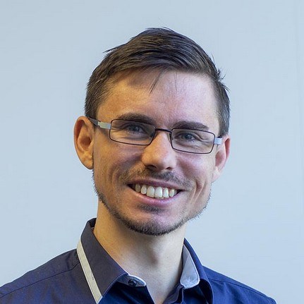
I’m Jesse Cannon, a British marine geophysicist and the founder of Critical Angle. I started offshore on exploration seismic crews for major oil and gas clients and rose to Chief QC Geophysicist on 3D ocean-bottom cable surveys. In 2014 I moved into near-surface geophysics: the seabed and shallow geology that wind farms, cables and pipelines are built on.
Since 2016 I’ve freelanced on eighteen contracts, aboard survey vessels, in site offices and, more and more, from home. Clients have always reviewed my work positively, and I intend to keep it that way: thorough, data-driven and honest about what the data can and can’t tell you.
Particulars
- Name
- Jesse Cannon
- Flag
- British
- Operator
- Critical Angle SLU, Spain
- Type
- Marine geophysicist: magnetics, side-scan sonar and seismic
- Trading area
- European waters, or remote
- In service
- Since 2006
- Freelance record
- 18 contracts since 2016: 8 aboard, 2 in site offices, 8 remote
- Offshore wind
- 10 wind farms
- Certificates
- BOSIET with CA-EBS to July 2030, OEUK medical to June 2028, NEBOSH IGC
What I bring to a site survey
Six steps from deck to deliverable. The data on screen is simulated, but it’s the kind I process and interpret every day.
Remote by choice, offshore when needed
Since May 2021, every contract has been delivered from my home office, for Fugro and GeoXYZ.
The office is set up for production geophysics: a high-spec computer, backup power, 1 Gbps symmetrical internet and three screens. I work in your software, to your procedures and reporting templates, with the same QC discipline I bring aboard. It keeps me close to my family, and I’m still glad to join a vessel when the job needs someone on deck.
- Workstation
- High-spec computer, triple-screen display
- Power
- Backup power supply
- Connection
- 1 Gbps symmetrical internet
- Data security
- Cybersecurity bootcamp, Ironhack, 2026
- Remote record
- 8 contracts, 2021 to 2025
Freelance weeks per year, by where the work was done
Site characterisation contracts, 2016 to 2025
- Aboard a vessel
- Site office
- Remote
Show as a table
From Brittany to the Gulf of Bothnia
Eighteen freelance contracts since 2016, for survey contractors including Fugro, GeoXYZ, MMT and NSEA, on projects such as Arkona, Borssele, Neart na Gaoithe, Saint-Brieuc, East Anglia THREE, NordLink and the Northern Endurance Partnership.
- Offshore wind farms10
- Power cables6
- Gas pipelines2
- Offshore switching station1
- Fibre-optic cable system1
- Carbon capture and storage1
The software I work in
| Software | Used for | Experience |
|---|---|---|
| SonarWiz | Side-scan sonar processing, mosaics and contact picking | 11 contracts |
| Oasis montaj | Magnetic data processing and UXO target picking | 9 contracts, 7 for UXO |
| IHS Kingdom | Seismic and sub-bottom interpretation | 4 freelance contracts, plus EGS International, 2014 to 2015 |
| RadExPro | High-resolution seismic processing | Built a full template project and processing sequence |
| ProMAX | Exploration seismic processing and QC | 6 years offshore |
| QGIS, ArcGIS Pro | GIS, charting and deliverables | Well experienced |
| ArcMap, Global Mapper, Workbench | GIS and data review | Familiar |
Tell me about your survey
Whether you need someone aboard next month or a remote processor for a backlog of side-scan, send a few details and I’ll get back to you.
- Phone
- +44 7537 176071
- Company
- Critical Angle SLU